Sunday, June 12, 2011

History of the local St James Church.P

Present day St James Church

This is the present day church. It has a seafaring flavour. The furniture is all handmade from Red Cedar.

The lecten in the shape of the bow of a boat, symbolising the' Coming of the Light.'
A very impressive cruxification painting on bark by Australian artist Ray Crooke.
This painting was done in about 1954 and was originally in the Old Site church, photo below.
A painting by this artist recently sold on Thursday Is for $114,000.  This one was restored in about 1976 when it was moved to the new church.

 A painting of the old church which hangs in the new church.
This church was built at the Old Site in 6 weeks by the local people with local materials. The  roof and walls were of bark. The roof was replaced with corrugated iron in the 1970's.

Our first visitor to Lockhart River.

At the end of May our friends from Daintree, Trish and Andrew came to visit. We had an exciting weekend out exploring the local area and birdwatching.

Afternoon walk, beachcombing on Quintell Beach.

Fishing trawler off the beach at Portland Road.

Low tide at Chilli Beach

Ron and Trish birdwatching on Chilli Beach

Some of the very large trees in Iron Range National Park

Starfish found on Quintell Beach at a very low tide.

A feral pig encountered on a walk on Old Coen Rd.

Iron Range has many butterfies, not sure what this one is?
Whilst beachcombing at Portland Road Ron and Andrew found some war relics near where the wartime wharf was located.


Condor B24 LIberator (picture from IronRange Air Base carved in the Jungle 1942-1945 by Micheal Musumeci)
 On 15 December 1942 a B24 Liberator (4123824) had a forced landing after returning from a mission having run out of fuel, it was ditched on Qunitel Beach Lockhart River. Above is the Condor with one whell apparently collapsed and slowly going under water as the tide is coming in.

Wheel wing strut.

Wing part

Wing part
 All that is remaining of the B24 Liberator ditched on Quintel Beach Dec 1942. The chrome on the wheel strut is still in excellent condition. The aluminium and rivets on the wing part are also in good condition after 69 years.

Quintel Beach at a very low tide. The wreck is exposed further down this beach.

Some more of the town


 I decided to go for a walk and photograph some more of the buildings and services around Lockhart for everyone to see.


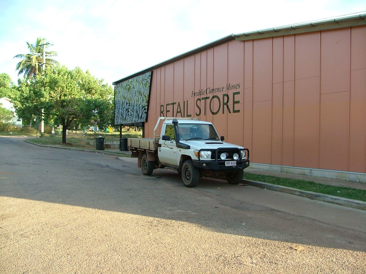
This is our local store. Fresh fruit and vegetables are reasonable, but most other items are marked up.


This is the local library, very basic, has internet and computers for use by community members.

The Land and Sea Rangers office

The Lockhart Art gallery. Many paintings range in the hundreds and thousands of dollars.


 This is our local hospital which is more like a medical clinic. The Flying Doctors come in 2 days each week and there are a number of nurses on call everyday.

This is a mural on the wall outside the hospital.

Another mural on the hospital wall.


This is accommodation for the Hospital staff.

The front entrance to the school.

Some of the teachers accommodation near the school.

The Local Council office.

Saturday, May 7, 2011

Sunrise at Quintell Beach

Yesterday I got up nice and early to try to capture some sunrise photos, and fortunately it was a glorious morning.
The big barge in again with some modular houses.


Early morning at the beach
Sunrise over Quintell Beach

Sunrise 

Sunday, May 1, 2011

A day out to the Pascoe River.


Yesterday we went for a drive to check out the Pascoe River. This is 56 km from Lockhart, but took us 1hr and 40 minutes to get there. This is in part due to the 43 creek or gully crossings in the last 19km. Only about 6 of these didn't have running water. The road also includes 10km of sealed road which seems quite strange in the middle of such an isolated area. On leaving town there are another 3 major creek crossings with causeways, but these are quite easy to cross now even though they have water over them.  Some locals have been crossing the Pascoe River by wading across with a rope and then winching themselves over, apparently with a bit of floating on the way! You then need to wait an hour or so on the other side to let the car dry out a bit!! No way we are attempting that kind of crossing!
The Pascoe River. This is what we are hoping is low enough to cross in June.
This is the western side road access of the Pascoe River.

One of the many creek crossings on the way.

Looking toward the McIllwraith Range


A very dried up bog, someone had some fun here a few weeks ago!

Another very picturesque creek crossing.

Yet another crossing.

The remains of a bridge built in WWII by the Yanks. Certainly have strong bases!
The view to Mt Tozer.

Me being a real tourist on the platform looking to Mt Tozer. This is the mountain the plane crashed into a couple of years back.

Raod to Pascoe River.

  A native hibiscus growing along the road to the Pascoe.


Small flower on the roadside.
Another small roadside flower.
Flowering grasses on roadside.
A dingo spotted on the road on our way home, he sat in the grass beside the road looking at us.

A blue tongue lizard, hypnotized by Ron!